|
iMahal:
We would like to talk about your archeology projects, including the latest one in India. How do these projects come about? And why this one in India?
The question you asked before about why Mesopotamia and what does that have to do with my cultural affinity, is one that I've spent a lot of time reflecting on. At the end of the day one of the problems involved in archeology is trying in some way to remove your cultural perspective, your cultural biases, and perhaps even your cultural prejudices from the type of work that you do.
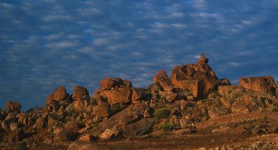
I became involved in Indian archaeology, about a year ago when I met a professor from the University of Pennsylvania, John Fritz, who has been running something called the Vijayanagara Research Project for the last 20 years. We had met at least once previously. When I had talked to him about the type of technologies I was using in Syria to document our excavation, he asked if he could come downtown to Archaeos's office and learn about how we did the mapping. He said, "I've had this idea for a long time: to look at this large area called the Northern Ridge in Vijayanagara, which lies between the Royal City and the Sacred City, and to see what kind of information we could tease out of this area, which is highly denuded."
I looked at this opportunity in several ways. First, I thought, this is a really interesting guy, with a new research idea that he wants to figure out how to implement. It's important to allow yourself not to be guided just by your own interests but also by the people you come into contact with who you think will be intellectually stimulating. Second, I realized that this research might be valuable to people. We would be recording material evidence that we might not have access to in the future: the evidence might eventually disappear. Third, this could further the aim of Archaeos to be involved in research concerning a variety of cultures.
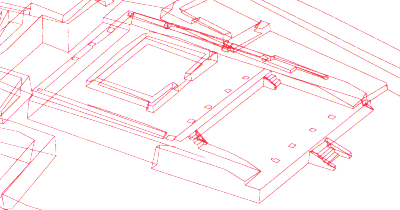
Finally, I also looked at it from a technological point of view, as some place where I could experiment with new technologies that are appearing. In some ways it was a bet. I didn't know anything about India and I still don't claim to know very much about India. I looked at it as an experiment, one that might lead to new methodologies for recording archeological information. That is one of the things that I am really interested in. There are a lot of tremendous technologies out there you could use to document archeology, but archeology has remained very traditional. In a sense it's a two-dimensional art. Most archeologists still present their information in two dimensions. For example, they publish ground plans in books. But the technology is changing and I believe that archaeology will rapidly change with it. We can now model information three-dimensionally, and we can take not only spatial data, in other words x-y-z coordinates, and use that to create maps, but we can also link it to all sorts of other documentation.
To give you one example, we experimented with these 360-degree QTVR (QuickTime Virtual Reality) panoramas when I was down there. The way that they work is that you place a camera on a leveled tripod and spin it along a horizontal axis as you take a series of photographs. These photographs are then scanned as digital images and knitted together on a computer to create a visual panorama. I was originally unenthusiastic about this process and did the whole thing as an experiment. When I came back to New York, however, and saw the results I realized that that this method of documentation is something that we are going to emphasize as soon as we return to the field. What we are going to do is something I like to call nodal QTVR mapping. The basic concept is as follows. We'll take the Total Station, which is our primary surveying instrument, and shoot a coordinate point so we know exactly where it is in space. Next we'll put the photographic tripod down on top of the point we just shot, stick the camera on a QTVR head, and shoot a 360-degree pan of the surrounding area. This will all be done with a digital camera so that it can be directly imported into the computer while we are still on site. The resulting QTVR pan will have the ability to be rotated in various directions and will include the ability to zoom in or out on any part of the image. Each QTVR will then include one or more "hot spots," areas that the viewer can click on in order to view the next QTVR node, in other words the next adjoining 360-degree view. The coordinates of each QTVR will be indicated on our site maps and models and defined by clickable areas that will be linked to the 360-degree panoramas. By doing this we'll be able to combine two types of information: (1) the traditional coordinate geometry readings that we use to create 3-D Computer Assisted Design (CAD) renderings, and (2) the visual documentation information contained in the QTVR images. Eventually, there is the possibility that we will be able to hyperlink various other forms of data into the same model. The possibilities are endless; we will be constrained only by budgets. Ultimately, most of what humans do in terms of cognition is visual processing. Language is principally an interface, or inference, mechanism back into deeply defined and hidden levels of thought. One of its functions is as a feedback mechanism from our conscious to our sub-conscious cognitive processes.
So, what I want to do is collect as much data as we can in as many ways as possible and disseminate it as broadly as we can. If Archaeos had the money, we would be collecting some of it with satellites. Archaeos collects as much data as is possible with all of these technologies, processes it, and eventually tries to make it public. Although we place our own interpretations on the data sets, we won't limit the ability of other people to interpret it as well. I want all sorts of alternative thinking involved. We are just the first attempt in a continual process of trying to understand this information.
A lot of people tend to guard information. I don't think that is the proper direction for somebody who is genuinely interested in the culture to take. I think we should want alternative viewpoints. I want Indians to look at this information and come to their own opinions of it. In fact, I'd be much happier if I had the opportunity to train local scholars to utilize this technology and eventually run the project with us, because after all, it's their culture.
All photographs copyright and courtesy of David Gimbel or Archaeos
|
 |
|
|
|||||